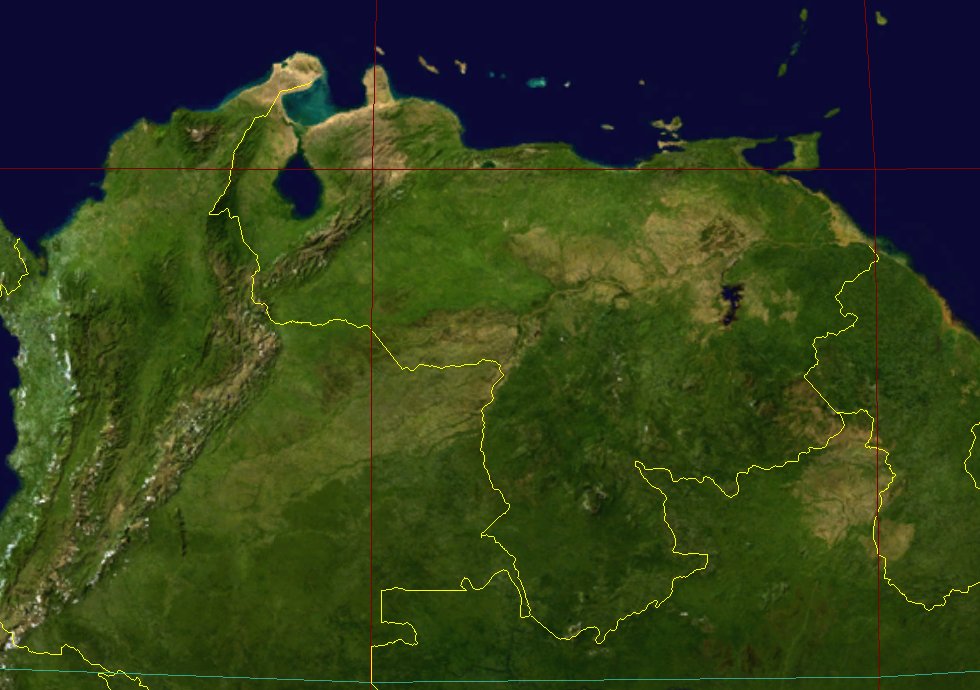

The red vertical lines are the Meridians for 70° W (to the left) and 60° W (to the right).
The red horizontal line is the Parallel for Latitude 10° N. The blue horizontal line is the Terrestrial Equator (Lat. 0°).
The yellow lines represent approximate conventional borders (not official). The territory West (to the left) of Venezuela is Colombia, Brazil is to the South (downwards), Guyana is to the East (to the right).
For names of States and Capitals, limits, and main roads, see the
Relief Map of Venezuela (in ARVAL).
This spectacular "Blue Marble" image is a small part of the most detailed true-color image of the entire Earth to date (1 Km per pixel resolution).
Much of the information contained in this image came from a single remote-sensing device: NASA’s Moderate Resolution Imaging Spectroradiometer (MODIS) flying over 700 Km above the Earth onboard the Terra satellite.
Topographic shading is based on the GTOPO 30 elevation dataset compiled by the US Geological Survey (USGS).
Two different types of ocean data were used in these images: shallow water true color data, and global ocean color (or chlorophyll) data.
The land and coastal ocean portions of these images are based on surface observations collected from June through September 2001.
This image was produced by Observatorio ARVAL with NASA's free program World Wind, from NASA Learning Technologies (NLT).
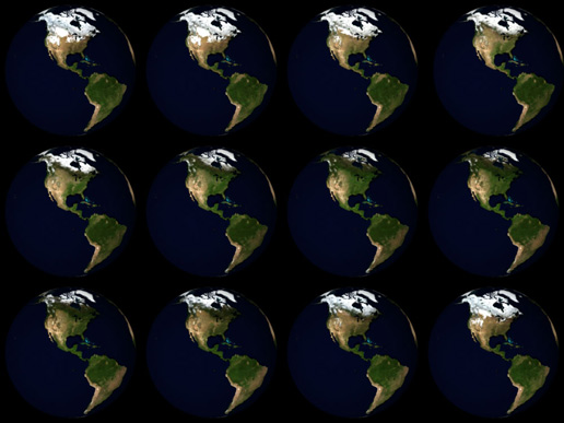
In October 2005, NASA released a new version of the spectacular image collection that provides a full year's
worth of monthly observations with twice the level of detail as the original (500 m per pixel resolution).
The new collection is called the
"Blue Marble: Next Generation".
 This image shows the Americas in twelve monthly panels with January 2004 in the upper left corner,
and December 2004 in the lower right corner.
Credit: NASA Earth Observatory.
Blue Marble: Next Generation is a mosaic of satellite data taken mostly from a NASA sensor called the
Moderate Resolution Imaging Spectroradiometer (MODIS)
that flies aboard NASA’s Terra
and Aqua satellites.
To access the images of the
Blue Marble: Next Generation
you can use the free program
YaWah - Blue Marble Next Generation Viewer
(uses the Macromedia Flash Player).
NASA's free program World Wind uses the images of the Blue Marble: Next Generation from October 21 '05. Now it also covers the surface of the Moon, Venus, Mars, Jupiter and the sky.
Also see the site OnEarth (Landsat 7, WMS Global Mosaic of the Earth Web Map Service).
To access the most detailed satellite images you can use the excellent free program Google Earth (Topographic Map of the Earth).
![]() This page was updated in: August 26 '07, June 17 '14
This page was updated in: August 26 '07, June 17 '14
Best seen with Font Verdana.
See About the Web Pages of Observatorio ARVAL
Back: Observatorio ARVAL - Home Page
Spanish: Mapa Topográfico de Venezuela
Messages: